| NWS Weather Forecast -
Outlook Overnight & Wednesday |
Overnight

Isolated Rain Showers
Lo 65 °F
|
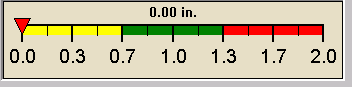
NWS forecast: Isolated rain showers after 4am. Mostly cloudy, with a low around 65. North wind around 0 mph. Chance of precipitation is 20%.
|
Wednesday

Scattered Showers And T-Storms
Hi 83 °F
|
NWS forecast: Isolated rain showers before 7am, then scattered showers and thunderstorms. Mostly cloudy, with a high near 83. Northeast wind around 0 mph. Chance of precipitation is 40%. New rainfall amounts less than a tenth of an inch possible.
|
|
| NWS Short Term Weather Forecast - Click here for 7 day forecast |
|
Wednesday
Night

Scattered Showers And T-Storms then Patchy Fog
|
Thursday

Chance Showers And T-Storms
|
Thursday
Night

Chance Showers And T-Storms
|
Friday

Partly Sunny then Isolated Showers And T-Storms
|
Friday
Night

Isolated Showers And T-Storms then Mostly Cloudy
|
Saturday

Mostly Sunny
|
Saturday
Night

Partly Cloudy
|
|
Lo 65 °F |
Hi 78 °F |
Lo 64 °F |
Hi 82 °F |
Lo 63 °F |
Hi 86 °F |
Lo 66 °F |
|
Countdown to Summer |
Summer Solstice begins June 20, 2025 at 10:43 pm EDT
|
|